The vote last week was transformative in a sense. In many ways, however, the election produced no change at all. The country is split in much the same way it was divided four and eight years ago. People continue to sort by age and by way of life. As a result, our communities (and states) are growing more like-minded.In his regular blogging place, Daily Yonder, Julie Ardery notes the importance that college towns played in Obama's victory, and reports on how one student made his decision:
Oh, and there is the continuing and stark racial division in both the geography and how Americans live. In Republican-landslide counties, blacks and Hispanics are distinct minorities. Where McCain won by 20 percentage points or more, there were five Anglos of voting age for every black or Hispanic, Cushing found. In Obama-landslide counties, there are 1.3 whites for every black or Hispanic. Obama counties and McCain counties are very different places.
Liberals and Democrats seem to think the country's divisions have disappeared just because their man won. And it is easy to ignore people on the other side when they aren't your neighbors. But that doesn't mean the country is less polarized-because it isn't.
According to an Indianapolis news station, "An IU student who identified himself as a Republican said he threw his support to Obama at the last minute because of the something the Democrat said on ‘Monday Night Football.’Oh well.
"'He was asked, "What would you change in college football," and he said he wanted a playoff system,' said IU student Ben Dyar. 'It was really tied before that, but that pretty much sent me over the edge. I decided to vote for Obama.'"
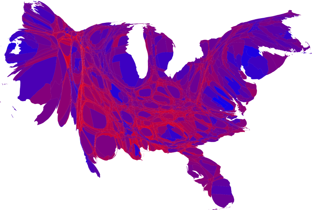
Meanwhile, the guys who analyzed the 2000 election data and showed that the red-state/blue-state divide is not accurate, and that the country is varying shades of purple, have more interesting cartograms based on the 2008 data. They note that:
large portions of the country are quite evenly divided, appearing in various shades of purple, although a number of strongly Democratic (blue) areas are visible too, mostly in the larger cities. There are also some strongly Republican areas, but most of them have relatively small populations and hence appear quite small on this map.
No comments:
Post a Comment